|
|
|
|
|
|
|
|
|
|
 |
|
 |
|
|
 |
|
|
|
|
|
Menke and Yenasr Islet |
|
|
|
|
Kosrae State, FSM - August 1999
The Sleeping Lady from Yenasr Islet
August 4, 1999
Today was an office day, spent between labwork (mainly making sure all the bags of midden and artifacts we have recovered over the course of my time here are labeled) and reviewing the historic preservation legislation Berlin has been revising. I gave him a copy of the draft legislation I drew up for Pohnpei, which he went through and made the appropriate changes.
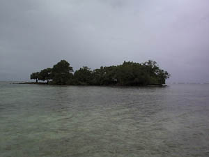
Tomorrow we will map Yenasr Island, the sacred island of Leluh, where Tridacna adzes were manufactured and the bones of kings (high chiefs and paramounts) were taken to deposit in the hole in the reef just off the island.
August 5, 1999
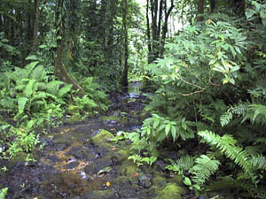
It is not looking like a very nice day; the weather is a bit unsettled. Last night we had a series of rainstorms that have continued into the morning. Nevertheless, we are bound and determined to map Yenasr Island. This is a good time, owing to the tides. We have to walk out to the island through the lagoon; low tide makes that passage a little easier. The island is a small natural reef that has been expanded by fill to the ocean side, creating a flat rectangular pavement raised just above the water level. It has four foundations: two were likely originally constructed with the island, two are later additions, with one built perhaps 70 to 100 years ago, and the second built more recently. The two original foundations consist of a house platform and a feast house, complete with a seka stone and a paved ramp that leads from the water into the feast house proper. There is also what appears to be a canoe landing area, between the house platform and feast house; at least one, if not two, shell workshops on the artificial flat of the island; a cluster of fire-cracked rock indicating cooking and food preparation; and lots and lots of midden. The shell workshops contain the raw materials and debris from the manufacture of shell adzes; generally the giant clam, Tridacna, was used, although other bivalves are mixed into the debris as well. There are also files made out of both coral and small pieces of columnar basalt. I am sure that if we had more time and better weather, we could see more across the island in terms of the debris from daily activities.
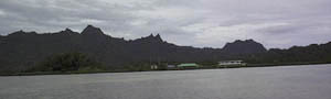
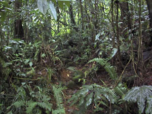
Yenasr Islet from the lagoon on our way there
Berlin, Nena, Lupalik and I made our way there. It had stopped raining by the time we left the office, although there was no telling if it would begin again. Berlin said he would meet us there, and left to change his clothes. The three of us, Nena, Lupalik and me, got to the island, did a preliminary review (looking for the best place to set up the instrument), and even began to do some work. We had barely got through our first couple of mapping points by the time Berlin arrived, yelling as he did, "break time". The three of us protested, we had just started, we didn't want to stop. Berlin, however, had brought us lunch, and insisted that we could not continue working until we had all eaten. We did. Then the rains started, slowly at first, followed by a couple of downpours with heavy winds, then calm, then it would start all over again.
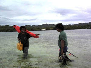
Nena and Lupalik hauling the gear to Yenasr Islet
Mapping with this motley band was like working with the three stooges. I laughed almost the entire day. If it wasn't Nena getting confused over reading angles off the level, or Berlin who kicked Nena off the instrument, then it was listening to Lupalik complain about the rain and walking over corals, or watching the pair of Nena and Lupalik selecting mapping points. Nena would usually select our next point, but always with the intent of creating a most difficult route for Lupalik to follow with the tape between the instrument and the mapping point. Most of the conversations, curses and complaints were in Kosraean, with all three taking part; yet in spite of the language used, I found the whole day a comedy. We were wet, cold, and shivering, yet we accomplished a great deal, mapping nearly the entire island, leavingt just a small portion to be completed next week.
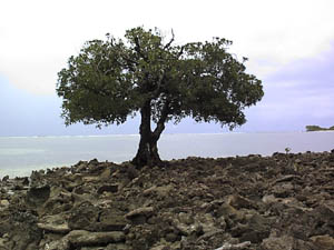
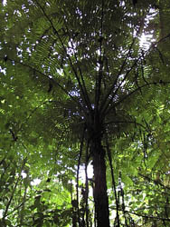
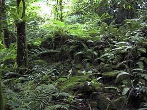
A lone tree on Yenasr Islet
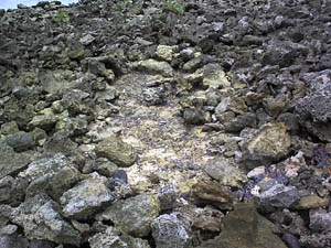
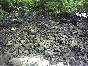
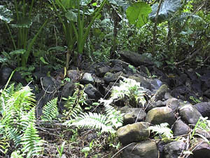
The foundation depicted in the photograph here is likely the most recent foundation on the island. Likewise the path show here. Neither have the characterisics of the orderliness or detailed arrangement relative to other features; they simply do not "fit" the pattern of the prehistoric constructions. They are not made with the same care or skills as the prehistoric features. The island is used for picnics, by fishermen, and generally by anyone who makes their way to it. It is not surprising, then, to see some rearranging of the coral base and pavement to create something like the path you see in one of the images, or cooking areas, or even more recent platforms on which to rest.
Yenasr foundation, probably of more recent origin
Yenasr path, probably somewhat new
The Tridacna core and flake shown here are part of the largest shell workshop on the island.
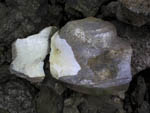
Tridacna core |
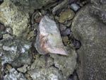
Tridacna flake |
August 6, 1999
 I went to the Menke Ruins today, accompanied by Bruce from KVR and our guide, Ackley Morris Wakuk, grandson of the owner. Menka is also referred to as the Sinlaka site. Sinlaka was the breadfruit goddess, and was at one time the most important diety on the island. Her site is more or less centrally located on the island, in the south half. To get there, we had to follow one of the rivers up from Utwe, part of which took us onto some very old pathways built along the river and complete with retaining walls and a tread that has undoubtedly been walked upon by countless generations. In the past, people used various passages to arrive at the site: overland trails as well as paths through and alongside various stream drainages. The site is pre-Leluh in age, before the paramountcy, when Sinlaka stood as the master of the island, so to speak. People would gather perhaps once a year to pay homage, although her priests would perhaps gather more frequently than that and meet for private conferences at a meeting platform that supported seven large standing stones (backrests), according to Ackley. He had seen this meeting platform about 10 years ago, but has not been able to find it since then. Needless to say, we did not see it either. I went to the Menke Ruins today, accompanied by Bruce from KVR and our guide, Ackley Morris Wakuk, grandson of the owner. Menka is also referred to as the Sinlaka site. Sinlaka was the breadfruit goddess, and was at one time the most important diety on the island. Her site is more or less centrally located on the island, in the south half. To get there, we had to follow one of the rivers up from Utwe, part of which took us onto some very old pathways built along the river and complete with retaining walls and a tread that has undoubtedly been walked upon by countless generations. In the past, people used various passages to arrive at the site: overland trails as well as paths through and alongside various stream drainages. The site is pre-Leluh in age, before the paramountcy, when Sinlaka stood as the master of the island, so to speak. People would gather perhaps once a year to pay homage, although her priests would perhaps gather more frequently than that and meet for private conferences at a meeting platform that supported seven large standing stones (backrests), according to Ackley. He had seen this meeting platform about 10 years ago, but has not been able to find it since then. Needless to say, we did not see it either.
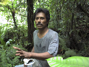
Ackley Morris, grandson of the owner at Menke
Path into Menke
The site is extensive, and in my mind more impressive than Leluh, owing to the scale, condition and extent of the remains. It has not been subject to disturbance by development; the only thing affecting its condition is nature itself. The site is beautiful, obscured in great part by the jungle. Several medicinal plants are scattered throughout the drainage. Ackley pointed them out, described their uses and how they were prepared; his family is one of those who were medicine men. I don't think I could tell you what plants were used for what, even after having them pointed out to me; I could barely tell one ginger from another. The architecture, though, is what fascinated me the most over the course of the day. The sheer pleasure of seeing a well-made, intact wall rise from the vegetation was extraordinary. It was like stepping back in time, to a remote and distant past. One wonders if you stand still long enough, whether you will hear the echo of the seka stones pounding the roots of the kava plant or whispered chants of long ago. This is ancient landscape, and lacks only the people who once occupied it. The site is located in a large drainage, with a hundred or more compounds distributed on both sites of the river, in close proximity to one another. The compounds are like so many of the others we have seen on the island, divided into two sections, with one containing a sleeping house platform and the other containing the cooking and activity area. The gates into the compounds and between the interior sections are similar to those we encountered at Palusrik in Utwe; they consist of a raised floor about half the height of the wall.
Menke, hidden architecture
Menke, first compound
Some of the platforms were raised double tiers, with a pavement of small stones and pebbles at the very top to create a smooth, leveled surface. I think these probably belonged to the higher-ranked clans. The walls around the compounds range anywhere from about a meter high to perhaps 5 meters; they are quite extensive and very elaborate, built of local stone gathered, it appears, from the rivers themselves (and perhaps even local boulder fields that would continually introduce more material into the riverbeds). All the skills necessary to build Leluh were already in place on the island and visible in the construction methods displayed within the compounds here.
It is said that with the rise of the paramountcy in Leluh, Sinlaka's position on the island was somewhat diminished. She still received annual tribute, and still had priests as her representatives, but her power in the overall organization of the island was transferred to the paramount.
In 1852, with the arrival of Reverand Snow and his band of missionaries, she fled the island and went to Yap.
Like so many sites, Menke is outside of oral history, other than a few remnant stories that mostly center around Sinlaka and not her site. No one seems to be able to relay stories about the families who would gather, about the annual tributes, about the priestly conferences, about much of anything related to activities at the site or its place in the history of the island. There has been no archaeological survey here, no map, no scientifically derived dates. Other than general information about the extent of the site, no one really knows for sure just how extensive it is, how it is organized, or the pattern of remains. No one can say for sure if lower-ranked clans also participated in pilgrimages to the site, or if they also had houses but without compound walls. During our visit, I noticed a number of midslope benches that could have supported a small household, although with vegetation growth and soil build-up, no features were visible on the surface (well, what we could see of the surface).
Menke, compound wall
This is the kind of site that deserves a concerted interdisciplinary investigation. The conditions and circumstances are ideal for the archaeologist, the geologist, the biologist, and others.
Next: Yenasr Islet and Leluh
|
|
|
